Satellite image processing platforms help us turn raw space pictures into useful information. Tools like ERDAS Imagine make sense of complex geospatial data. They help scientists, city planners, farmers, and even students understand our planet better. What looks like a colorful image from space is often full of hidden data waiting to be unlocked.
TLDR: Satellite image processing platforms like ERDAS Imagine turn raw satellite data into meaningful maps and insights. They help analyze land, water, cities, forests, and more. These tools use classification, enhancement, and modeling to reveal patterns. They make complex geospatial data easier to understand and use.
Let’s break it down in a fun and simple way.
What Is Satellite Image Processing?
Satellites orbit Earth and take pictures. But these are not normal photos. They capture data in many wavelengths. Some show heat. Some show moisture. Some see things invisible to the human eye.
This raw data is powerful. But it is messy. It needs cleaning. It needs organizing. It needs interpretation.
That is where satellite image processing platforms come in.
They help:
- Enhance blurry or dull images
- Classify land types like water, forest, or buildings
- Detect change over time
- Measure distance, area, and patterns
- Model real-world scenarios
Think of them as smart translators. They turn space data into human language.
Meet ERDAS Imagine
ERDAS Imagine is one of the most well-known geospatial image processing tools. It has been around for decades. It is powerful. It is trusted.
Government agencies use it. Environmental scientists use it. Urban planners rely on it.
But what makes it special?
Key Features of ERDAS Imagine
- Raster Processing: Works with pixel-based images like satellite photos.
- Spatial Modeling: Builds models to analyze geographic relationships.
- Supervised and Unsupervised Classification: Identifies land cover types.
- Change Detection: Compares images from different dates.
- 3D Visualization: Creates terrain models.
Imagine you want to know how much forest was lost in the past 10 years. ERDAS Imagine can compare two satellite images. It highlights the differences. Forest shrinkage becomes clear. Fast and visual.
How Does Image Classification Work?
Classification sounds complicated. It is not.
The software groups pixels into categories. Each pixel has values. These values represent light intensity in different bands.
For example:
- Water reflects light differently than soil.
- Healthy plants reflect infrared strongly.
- Concrete has its own signature.
The software reads these signatures. Then it labels areas as “water,” “forest,” “urban,” or more.
There are two main types:
1. Supervised Classification
You train the software. You tell it what forest looks like. It finds similar pixels.
2. Unsupervised Classification
The software groups pixels automatically. You label them later.
Simple idea. Big results.
Other Popular Satellite Image Processing Platforms
ERDAS Imagine is great. But it is not alone. Several other platforms compete in this space.
- ENVI
- ArcGIS Pro with Spatial Analyst
- QGIS with Orfeo Toolbox
- PCI Geomatica
Each tool has strengths. Let’s compare them.
Comparison Chart of Popular Platforms
| Platform | Best For | Ease of Use | Advanced Analysis | Cost |
|---|---|---|---|---|
| ERDAS Imagine | Professional remote sensing analysis | Moderate | Very High | High |
| ENVI | Spectral analysis and research | Moderate | Very High | High |
| ArcGIS Pro | Integrated GIS workflows | Beginner Friendly | High | High |
| QGIS | Open source projects | Moderate | Medium to High | Free |
| PCI Geomatica | Radar and large data processing | Advanced | Very High | High |
If you are a student, QGIS might be enough. If you are managing national satellite data, ERDAS or ENVI may be better.
Real-World Applications
Now let’s see where this becomes exciting.
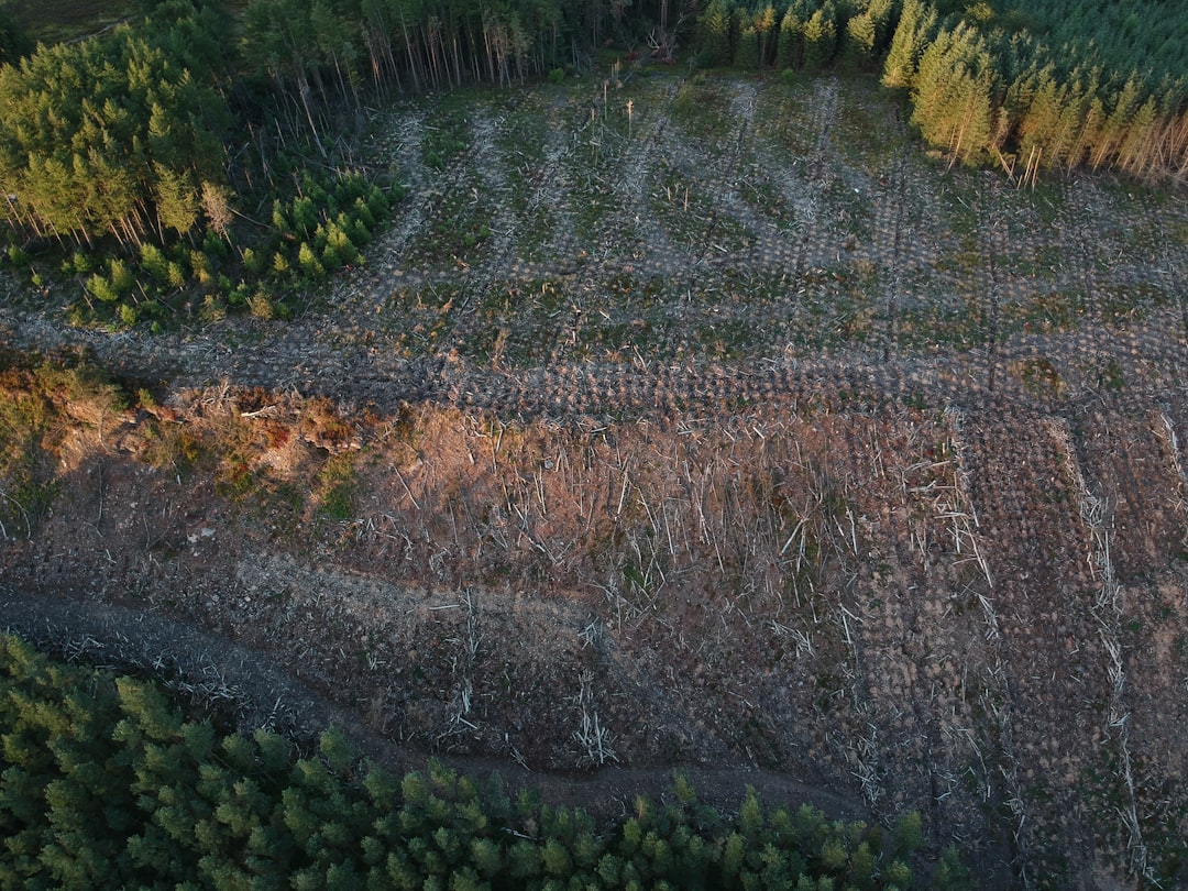
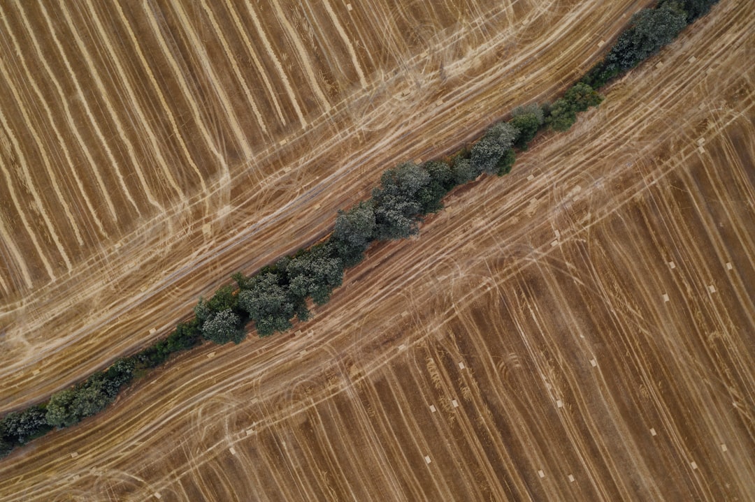
1. Environmental Monitoring
Forests are shrinking. Glaciers are melting. Rivers are changing course.
Satellite platforms detect these shifts. Scientists track deforestation. They monitor drought. They study wildfires.
Without image processing software, this would take years. Now it takes hours.
2. Agriculture
Farmers use satellite imagery to check crop health. Infrared bands reveal stress in plants before it is visible.
This helps farmers:
- Use less water
- Apply fertilizer precisely
- Increase yield
Smart farming starts from space.
3. Urban Planning
Cities grow fast. Planners need updated maps.
Satellite image platforms help measure:
- Urban expansion
- Road networks
- Population density patterns
They also help plan greener spaces.
4. Disaster Management
Flood? Earthquake? Hurricane?
Satellite data shows damage quickly. ERDAS Imagine can process before-and-after images. Emergency teams see where help is needed most.
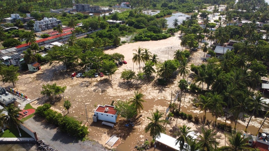
Time saved means lives saved.
Understanding Raster vs Vector Data
Most satellite images are raster data. That means they are made of pixels.
Each pixel has a value. Together they form an image.
Vector data is different. It uses points, lines, and polygons.
Satellite image processing platforms mostly focus on raster. But they often combine raster with vector layers.
For example:
- Raster shows land temperature.
- Vector shows city boundaries.
Overlay them. Now you know which city areas are hottest.
What Makes ERDAS Imagine Powerful?
It is not just about viewing images. It is about analysis.
ERDAS Imagine includes:
- Batch processing for large datasets
- Model builder for automated workflows
- Machine learning tools for better classification
- Radar data support
Its spatial modeler lets users drag and drop functions. No heavy coding needed. That makes advanced analysis more approachable.
You can build a model once. Then reuse it again and again. This saves time.
The Role of Artificial Intelligence
Modern image processing platforms now use AI.
Machine learning improves classification accuracy. Deep learning detects objects like cars, buildings, or ships.
Instead of simply labeling forest, software can detect tree species. Instead of marking urban areas, it can count rooftops.
This is the future of geospatial intelligence.
Is It Hard to Learn?
At first, yes. The interface can look complex.
There are many buttons. Many layers. Many settings.
But the core ideas are simple:
- Enhance the image
- Classify the pixels
- Analyze the results
With practice, it becomes logical. Many universities teach these tools. Online tutorials help a lot.
Start small. Explore one function at a time.
The Big Picture
Our planet changes every day. Satellites capture those changes constantly.
But data alone means little. Interpretation is everything.
Platforms like ERDAS Imagine transform satellite imagery into insights. They help protect forests. They improve farming. They guide urban growth. They support disaster relief.
They make the invisible visible.
The next time you see a colorful satellite map, remember this: behind it stands powerful software. Behind that software stands smart analysis. And behind that analysis stands a better understanding of Earth.
Space may feel far away. But with the right tools, it helps us manage life right here at home.