Boating is freedom. The wind. The spray. The open water. But it also comes with responsibility. You need to know where you are. You need to know what is around you. And you need to get back home safely. That is where marine navigation software like OpenCPN comes in. It turns your laptop or tablet into a powerful navigation station. And it does it without being complicated.
TLDR: Marine navigation software like OpenCPN helps boaters travel safely using digital charts, GPS, and real-time data. It shows your position, warns you of hazards, and helps plan routes. OpenCPN is free, flexible, and packed with smart features. Whether you sail for fun or fish offshore, it makes navigation easier and safer.
Why Navigation Software Matters
In the old days, sailors used paper charts and a compass. That still works. But today, we have better tools. Digital navigation software combines maps, GPS, weather, and radar. All in one screen.
It helps you:
- Know your exact position in real time
- Avoid shallow waters and hidden hazards
- Plan routes before leaving the dock
- Track your movement and speed
- Stay updated with weather and tide data
Instead of guessing, you see everything clearly. That means less stress. And more fun.
What Is OpenCPN?
OpenCPN stands for Open Chart Plotter Navigator. It is free. It is open-source. And it is built by sailors, for sailors.
You can install it on:
- Windows computers
- Mac computers
- Linux systems
- Some Raspberry Pi devices
It connects to your boat’s GPS. It displays charts. It tracks your route. And it supports plugins that add extra features.
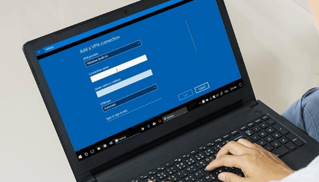
Here is what a typical setup may look like:
Image not found in postmetaIt may look technical. But once you start using it, it feels natural.
Key Features That Keep You Safe
1. Real-Time GPS Tracking
OpenCPN shows your boat on a digital chart. In real time. You can see:
- Your heading
- Your speed
- Your course over ground
If you drift off course, you will see it immediately. That is powerful.
2. Detailed Nautical Charts
You can load official and community charts. These charts show:
- Depth contours
- Buoys and markers
- Rocks and reefs
- Harbors and marinas
This helps you avoid danger. Especially in shallow or unfamiliar waters.
3. Route Planning
Planning ahead is smart boating.
With OpenCPN, you can:
- Create waypoints
- Connect them into routes
- Calculate distances
- Estimate travel time
You can plan your trip at home. Then follow it on the water.
4. AIS Integration
AIS stands for Automatic Identification System. Large ships use it. Many sailboats do too.
When connected, OpenCPN shows nearby vessels. You see:
- Ship names
- Speed
- Direction
- Closest point of approach
This helps prevent collisions. Especially at night or in fog.
5. Weather and Tides
Weather changes fast. Water moves constantly.
With the right plugins, OpenCPN can display:
- Wind forecasts
- Storm patterns
- Tidal currents
- Wave heights
You do not just react. You prepare.
Why Sailors Love OpenCPN
It is not just about features. It is about freedom.
It is free. No heavy subscription fees.
It is customizable. You add only what you need.
It has a strong community. Thousands of users share advice and plugins.
It works offline. Once charts are downloaded, you do not need internet.
This makes it perfect for coastal cruising. Offshore sailing. Even liveaboard lifestyles.
How It Compares to Other Navigation Software
OpenCPN is not the only option. There are other marine navigation tools available. Some are mobile apps. Others are premium systems.
Here is a simple comparison:
| Feature | OpenCPN | Navionics App | TimeZero |
|---|---|---|---|
| Price | Free | Subscription | Paid License |
| Platforms | Windows, Mac, Linux | iOS, Android | Windows |
| AIS Support | Yes | Limited | Yes |
| Customization | High (Plugins) | Low | Moderate |
| Offline Use | Yes | Yes (Downloaded charts) | Yes |
Each option has strengths.
If you want simple and mobile, an app may work.
If you want maximum control and flexibility, OpenCPN stands out.
Setting Up OpenCPN on Your Boat
You do not need to be a tech expert. Setup can be simple.
- Install the software on your computer.
- Download marine charts for your region.
- Connect a GPS receiver.
- Mount your screen securely near the helm.
Some boaters use waterproof laptops. Others use small marine PCs. Some connect it to larger onboard displays.
Make sure:
- Your setup is protected from water
- Your power supply is stable
- You always carry a backup navigation method
Electronics are powerful. But being prepared is smarter.
Safety Tips When Using Navigation Software
Software helps. But it does not replace seamanship.
Keep these safety habits:
- Always carry paper charts as backup
- Keep your eyes outside, not only on the screen
- Update charts regularly
- Test your system before long trips
Think of OpenCPN as your co-pilot. Not your captain.
Real-Life Example: Coastal Cruising
Imagine you are sailing along a rocky coastline. The wind is strong. The tide is pushing sideways.
On your OpenCPN screen, you see:
- Your boat slightly drifting off planned route
- Shallow water coming up ahead
- A cargo ship approaching from starboard
You adjust early. You change course slightly. You give way safely.
No panic. No last-minute surprises.
That is the power of clear information.
Is OpenCPN Right for You?
Ask yourself:
- Do I want a free and powerful navigation tool?
- Am I comfortable using a laptop onboard?
- Do I enjoy customizing my setup?
If yes, then OpenCPN could be perfect.
If you prefer something that works instantly on your phone with minimal setup, then a mobile-only app may be better.
There is no single best choice. There is only the best choice for your boat and your style.
The Future of Marine Navigation
Marine navigation keeps improving.
We now see:
- 3D chart views
- Satellite overlays
- Cloud route syncing
- Advanced collision prediction
Open-source tools like OpenCPN continue to grow. Developers add new plugins. Users share ideas. The system evolves.
This means better safety. Better planning. And more confidence on the water.
Final Thoughts
Water is beautiful. But it can be unforgiving.
Marine navigation software like OpenCPN gives you awareness. It gives you data. And most importantly, it gives you time to react.
Time is everything at sea.
With the right setup, you can:
- Sail further
- Fish smarter
- Explore new coasts
- Return home safely
Navigation software will not replace skill or experience. But it will support both.
And when the fog rolls in. Or the wind shifts suddenly. You will be glad you have a digital guide by your side.
Safe boating starts with smart tools. And OpenCPN is one of the smartest tools you can bring aboard.