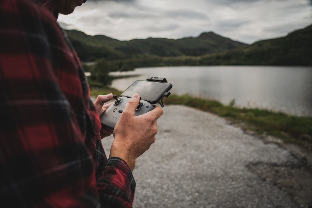
Drone technology has evolved rapidly in recent years, placing powerful aerial capabilities into the hands of hobbyists, content creators, surveyors, and commercial operators alike. Yet with this accessibility comes responsibility. Safe drone operation requires more than piloting skill—it demands awareness of airspace rules, weather conditions, hardware performance, and real-time risk factors. Drone flight apps have become essential tools for both beginners and seasoned professionals who want to fly safely, legally, and confidently.
TLDR: Drone flight apps help pilots check airspace restrictions, monitor weather, plan safe routes, and improve flight performance. Beginners benefit from guided flight tools and safety alerts, while professionals rely on advanced tracking, mapping, and compliance features. The best apps combine real-time data, regulatory updates, and intuitive design. Choosing the right app depends on experience level, location, and flight goals.
Whether you are flying recreationally or commercially, choosing the right flight app can significantly reduce risk and improve outcomes. Below, we explore the most trusted drone flight apps on the market, explain their strengths, and provide a comparison chart to help you decide which solution fits your needs.
Why Drone Flight Apps Matter
Every drone flight involves multiple variables:
- Airspace classification and restrictions
- Temporary flight restrictions (TFRs)
- Weather and wind speed at altitude
- GPS signal strength
- Battery health and return-to-home range
Without proper tools, a pilot risks violating airspace rules or encountering avoidable hazards. Modern drone apps integrate live aviation data, intelligent flight planning, and performance monitoring to help users make informed decisions before and during flight.
For beginners, these apps provide confidence and structure. For professionals, they offer compliance documentation, mapping support, and operational efficiency.
Top Drone Flight Apps for Safe and Confident Flying
1. DJI Fly / DJI GO 4
For pilots using DJI drones, DJI Fly (for newer models) and DJI GO 4 (for older models) are foundational. These apps serve as the primary flight interface and include:
- Real-time telemetry data
- Automatic geofencing alerts
- Return-to-home configuration
- Live HD video feed
- Built-in beginner modes
Best for: Beginners and intermediate DJI drone pilots.
The intuitive interface makes it especially suitable for new pilots, offering guided tutorials and simplified controls. It also integrates firmware updates and system diagnostics, which are essential for maintaining safe operations.
2. B4UFLY (FAA)
The FAA’s B4UFLY app is designed specifically to inform U.S. drone pilots about controlled airspace and restrictions. While simple in design, it is highly reliable for regulatory awareness.
- Real-time airspace status
- LAANC authorization links
- TFR notifications
- Airport proximity information
Best for: Recreational flyers and Part 107 pilots operating in the United States.
This app does not provide full-scale flight controls but works as a pre-flight safety check. It is particularly useful for avoiding accidental airspace violations.
3. AirMap
AirMap is a powerful airspace intelligence and flight planning platform. It integrates LAANC approvals, interactive maps, and geospatial awareness tools.
- Automated airspace authorization requests
- Interactive flight planning maps
- Real-time advisories
- Community-based updates
Best for: Commercial operators and serious hobbyists.
AirMap is especially valuable in urban areas where layered airspace regulations can be complex. The app reduces uncertainty and streamlines compliance processes.
4. UAV Forecast
Weather is one of the most underestimated risks in drone operations. UAV Forecast focuses entirely on providing detailed flight condition data.
- Wind speed at multiple altitudes
- Satellite visibility
- KP index (geomagnetic activity)
- Cloud cover and precipitation forecasts
- Custom flight condition thresholds
Best for: All pilots who prioritize safety and stability.
By setting maximum wind limits and visibility requirements, users can determine whether conditions are safe before leaving the ground. Professionals use it to assess risk for client projects, especially for inspections and mapping missions.
5. Litchi
Litchi is one of the most respected third-party flight apps for DJI drones. It unlocks advanced autonomous flight capabilities.
- Waypoint mission planning
- Orbit and focus modes
- Virtual reality FPV mode
- Mission Hub browser planning
Best for: Experienced pilots and content creators.
Litchi enables precise route programming, which is critical for repeatable commercial tasks such as real estate marketing or infrastructure inspection. However, it requires a strong understanding of drone handling and situational awareness.
6. DroneDeploy
DroneDeploy is tailored for mapping, surveying, agriculture, and industrial inspection.
- Automated grid flight planning
- 3D mapping and modeling
- Cloud-based data processing
- Enterprise fleet management tools
Best for: Commercial and enterprise-level pilots.
This app transforms drones into data collection systems. While beginners may find it advanced, professionals benefit from its automation precision and detailed analytics.
Comparison Chart of Leading Drone Flight Apps
| App | Primary Focus | Best For | Airspace Info | Weather Data | Advanced Automation |
|---|---|---|---|---|---|
| DJI Fly / GO 4 | Core flight control | Beginners to intermediate | Yes (basic) | Limited | Moderate |
| B4UFLY | Regulatory awareness | Recreational U.S. pilots | Yes (official FAA) | No | No |
| AirMap | Airspace management | Commercial operators | Yes (LAANC integrated) | Limited | Basic planning |
| UAV Forecast | Weather intelligence | All skill levels | No | Extensive | No |
| Litchi | Autonomous missions | Advanced users | Limited | No | High |
| DroneDeploy | Mapping & analytics | Enterprise users | Yes (planning support) | Limited | High |
Key Features to Look For
Not every pilot needs every feature. However, certain capabilities consistently enhance safe flying:
- Real-time airspace alerts – Prevents accidental violations.
- Weather integration – Avoids unstable flight conditions.
- Battery and signal monitoring – Reduces crash risk.
- Custom safety thresholds – Adapts the app to your risk tolerance.
- Flight logging – Essential for insurance and regulatory documentation.
Professionals should also prioritize compliance logging and automated reporting tools, particularly when operating under commercial drone regulations.
How Beginners Benefit from Flight Apps
For new pilots, anxiety often stems from uncertainty. Am I flying legally? Is the wind too strong? What happens if I lose signal?
Flight apps address these concerns by:
- Providing beginner flight modes with reduced sensitivity
- Issuing automatic warnings about restricted zones
- Calculating safe return-to-home distances
- Offering structured tutorials and onboarding guides
This structured guidance builds confidence without compromising safety. Over time, beginners transition from reactive flying to thoughtful, planned operation.
How Professionals Use Advanced Apps
Commercial drone operators face greater complexity. They must manage client expectations, minimize downtime, and comply with aviation authorities. Advanced apps allow them to:
- Pre-program inspection routes
- Collect geospatial data with high precision
- Maintain detailed maintenance logs
- Secure digital airspace authorizations quickly
These features reduce risk exposure and improve operational efficiency. In highly regulated environments, proper documentation is as important as piloting skill.
Building a Safe Drone Workflow
No single app does everything perfectly. Many professionals combine tools into a reliable workflow:
- Check airspace using B4UFLY or AirMap.
- Review weather with UAV Forecast.
- Plan automated mission in Litchi or DroneDeploy.
- Execute flight via DJI Fly or equivalent control app.
- Log and archive data for compliance and analysis.
This layered approach ensures regulatory compliance, environmental awareness, and mission precision.
Conclusion
Drone flight apps are no longer optional accessories; they are essential safety systems. For beginners, they reduce uncertainty and accelerate learning. For professionals, they enable structured risk management and technical precision. The right combination of airspace intelligence, weather monitoring, and automation tools transforms a drone from a recreational device into a reliable aerial system.
Safe flying is not just about avoiding crashes—it is about respecting regulations, protecting others, and maintaining operational control at all times. By integrating trusted drone flight apps into every mission, pilots at every level can operate with confidence, professionalism, and accountability.